Weather Alert in New Mexico
Red Flag Warning issued February 18 at 12:13PM MST until February 18 at 7:00PM MST by NWS Albuquerque NM
AREAS AFFECTED: East Central Plains
DESCRIPTION: ...RED FLAG WARNING TODAY 10 AM TO 7 PM FOR THE NORTHEAST AND CENTRAL HIGHLANDS, AND THE NORTHEAST AND EAST CENTRAL PLAINS, AND THE MIDDLE RIO GRANDE VALLEY DUE TO STRONG WINDS AND LOW HUMIDITY... ... FIRE WEATHER WATCH THURSDAY FROM 12 TO 6 PM FOR THE NORTHEAST PLAINS DUE TO STRONG WINDS AND LOW HUMIDITY... ...FIRE WEATHER WATCH FRIDAY FROM 1 TO 6 PM FOR THE EAST CENTRAL PLAINS DUE TO STRONG WINDS AND LOW HUMIDITY... .Another day of strong to potentially damaging southwest winds is expected today, with minimum humidities as low as 9 percent across eastern NM, where Energy Release Components vary from the 50th to 95th percentile and a couple of active wildfires are underway. After locally critical fire weather conditions and somewhat weaker winds on Thursday, wind speeds will strengthen again on Friday when widespread critical fire weather conditions are expected to return to the east central plains. * AREA AND TIMING...East Central Plains (Zone 126) today from 10 AM until 7 PM MST, and Friday from 1 to 6 PM MST. * 20 FOOT WINDS... For today, southwest 25 to 40 mph with gusts between 45 and 55 mph. For Friday, southwest 20 to 35 mph with gusts up to 45 mph. * RELATIVE HUMIDITY...For today, bottoming out from 9 to 13 percent. For Friday, 13 to 18 percent. * IMPACTS...Any fires that develop will likely spread rapidly. Outdoor burning is not recommended.
INSTRUCTION: Please advise the appropriate officials or fire crews in the field of this Red Flag Warning.
Want more detail? Get the Complete 7 Day and Night Detailed Forecast!
Current U.S. National Radar--Current
The Current National Weather Radar is shown below with a UTC Time (subtract 5 hours from UTC to get Eastern Time).

National Weather Forecast--Current
The Current National Weather Forecast and National Weather Map are shown below.

National Weather Forecast for Tomorrow
Tomorrow National Weather Forecast and Tomorrow National Weather Map are show below.

North America Water Vapor (Moisture)
This map shows recent moisture content over North America. Bright and colored areas show high moisture (ie, clouds); brown indicates very little moisture present; black indicates no moisture.

Weather Topic: What is Drizzle?
Home - Education - Precipitation - Drizzle
 Next Topic: Evaporation
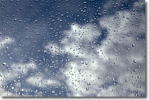
Drizzle is precipitation in the form of water droplets which are
smaller than raindrops.
Drizzle is characterized by fine, gently falling droplets and typically does not
impact human habitation in a negative way. The exception to this is freezing drizzle,
a condition where drizzle freezes immediately upon reaching earth's surface.
Freezing drizzle is still less dangerous than freezing rain, but can
potentially result in hazardous road conditions.
Next Topic: Evaporation
Weather Topic: What is Fog?
Home - Education - Cloud Types - Fog
 Next Topic: Fractus Clouds
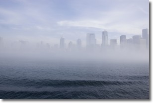
Fog is technically a type of stratus cloud, which lies along the
ground and obscures visibility.
It is usually created when humidity in the air condenses into tiny water droplets.
Because of this, some places are more prone to foggy weather, such as regions
close to a body of water.
Fog is similar to mist; both are the appearance of water droplets suspended in
the air, but fog is the term applied to the condition when visibility is less than 1 km.
Next Topic: Fractus Clouds
Current conditions powered by WeatherAPI.com


