Weather Alert in Kentucky
Special Weather Statement issued September 5 at 8:15PM EDT by NWS Jackson KY
AREAS AFFECTED: Johnson; Magoffin; Floyd; Breathitt; Knott; Martin; Pike
DESCRIPTION: At 815 PM EDT, Doppler radar was tracking a cluster of strong thunderstorms along a line extending from Warfield to near McCombs to near Lunah. Movement was east at 30 mph. HAZARD...Wind gusts up to 50 mph and pea size hail. SOURCE...Radar indicated. IMPACT...Gusty winds could knock down tree limbs and blow around unsecured objects. Minor hail damage to vegetation is possible. Locations impacted include... Pikeville, Paintsville, Prestonsburg, Inez, Mason, Coal Run Village, Martin, Forest Hills, Warfield, Allen, Meta, Pilgrim, Oaklawn Estates, Vail, Davella, Lancer, Piso, Burning Fork, Collista, and West Van Lear. THIS INCLUDES THE FOLLOWING HIGHWAYS... Kentucky Highway 3 in Floyd County between mile markers 1 and 4. Kentucky Highway 3 in Johnson County Kentucky Highway 3 in Martin County between mile markers 1 and 9. Kentucky Highway 80 in Floyd County between mile markers 2 and 14. U.S. Highway 119 in Pike County between mile markers 1 and 24. U.S. Highway 23 in Floyd County between mile markers 1 and 21. U.S. Highway 23 in Johnson County between mile markers 0 and 5. U.S. Highway 23 in Pike County between mile markers 26 and 32.
INSTRUCTION: If outdoors, consider seeking shelter inside a building. Torrential rainfall is also occurring with these storms and may lead to localized flooding. Do not drive your vehicle through flooded roadways. A Severe Thunderstorm Watch remains in effect until 100 AM EDT for southeastern and northeastern Kentucky.
Want more detail? Get the Complete 7 Day and Night Detailed Forecast!
Current U.S. National Radar--Current
The Current National Weather Radar is shown below with a UTC Time (subtract 5 hours from UTC to get Eastern Time).

National Weather Forecast--Current
The Current National Weather Forecast and National Weather Map are shown below.

National Weather Forecast for Tomorrow
Tomorrow National Weather Forecast and Tomorrow National Weather Map are show below.

North America Water Vapor (Moisture)
This map shows recent moisture content over North America. Bright and colored areas show high moisture (ie, clouds); brown indicates very little moisture present; black indicates no moisture.

Weather Topic: What are Nimbostratus Clouds?
Home - Education - Cloud Types - Nimbostratus Clouds
 Next Topic: Precipitation
A nimbostratus cloud is similar to a stratus cloud in its formless,
smooth appearance. However, a nimbostratus cloud is darker than a stratus cloud,
because it is thicker.
Unlike a stratus cloud, a nimbostratus cloud typically brings with it the threat
of moderate to heavy precipitation. In some cases, the precipitation may evaporate
before reaching the ground, a phenomenon known as virga.
Next Topic: Precipitation
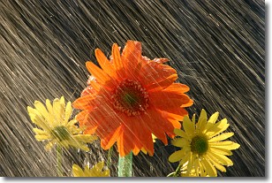
Weather Topic: What is Rain?
Home - Education - Precipitation - Rain
 Next Topic: Shelf Clouds
Precipitation in the form of water droplets is called rain.
Rain generally has a tendency to fall with less intensity over a greater period
of time, and when rainfall is more severe it is usually less sustained.
Rain is the most common form of precipitation and happens with greater frequency
depending on the season and regional influences. Cities have been shown to have
an observable effect on rainfall, due to an effect called the urban heat island.
Compared to upwind, monthly rainfall between twenty and forty miles downwind of
cities is 30% greater.
Next Topic: Shelf Clouds
Current conditions powered by WeatherAPI.com


