Weather Alert in New York
Blizzard Warning issued February 23 at 3:23AM EST until February 23 at 1:00PM EST by NWS Binghamton NY
AREAS AFFECTED: Sullivan; Pike; Southern Wayne
DESCRIPTION: * WHAT...Blizzard conditions. Additional snow accumulations between 2 and 4 inches. Winds gusting as high as 45 mph. * WHERE...In New York, Sullivan County. In Pennsylvania, Pike and Southern Wayne Counties. * WHEN...Until 1 PM EST this afternoon. * IMPACTS...Travel could be very difficult to impossible. Areas of blowing snow could significantly reduce visibility. The hazardous conditions could impact the Monday morning commute. * ADDITIONAL DETAILS...Blizzard conditions will be possible through Monday early afternoon. Peak gusts will be near 45 mph, especially in the higher elevations. Even if snow is not falling, freshly fallen snow could be lofted and result in visibilities below one quarter mile and drifts in open areas.
INSTRUCTION: Travel should be restricted to emergencies only. If you must travel, have a winter survival kit with you. If you get stranded, stay with your vehicle. In New York, The latest road conditions for the state you are calling from can be obtained by calling 5 1 1. In Pennsylvania, The Pennsylvania Department of Transportation and Pennsylvania Turnpike Commission strongly encourage motorist to heed all travel restrictions and delay unnecessary travel. Visit www.511pa.com for the latest travel, roadways, and traffic conditions.
Want more detail? Get the Complete 7 Day and Night Detailed Forecast!
Current U.S. National Radar--Current
The Current National Weather Radar is shown below with a UTC Time (subtract 5 hours from UTC to get Eastern Time).

National Weather Forecast--Current
The Current National Weather Forecast and National Weather Map are shown below.

National Weather Forecast for Tomorrow
Tomorrow National Weather Forecast and Tomorrow National Weather Map are show below.

North America Water Vapor (Moisture)
This map shows recent moisture content over North America. Bright and colored areas show high moisture (ie, clouds); brown indicates very little moisture present; black indicates no moisture.

Weather Topic: What is Precipitation?
Home - Education - Precipitation - Precipitation
 Next Topic: Rain
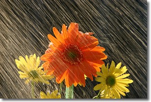
Precipitation can refer to many different forms of water that
may fall from clouds. Precipitation occurs after a cloud has become saturated to
the point where its water particles are more dense than the air below the cloud.
In most cases, precipitation will reach the ground, but it is not uncommon for
precipitation to evaporate before it reaches the earth's surface.
When precipitation evaporates before it contacts the ground it is called Virga.
Graupel, hail, sleet, rain, drizzle, and snow are forms of precipitation, but fog
and mist are not considered precipitation because the water vapor which
constitutes them isn't dense enough to fall to the ground.
Next Topic: Rain
Weather Topic: What are Shelf Clouds?
Home - Education - Cloud Types - Shelf Clouds
 Next Topic: Sleet
A shelf cloud is similar to a wall cloud, but forms at the front
of a storm cloud, instead of at the rear, where wall clouds form.
A shelf cloud is caused by a series of events set into motion by the advancing
storm; first, cool air settles along the ground where precipitation has just fallen.
As the cool air is brought in, the warmer air is displaced, and rises above it,
because it is less dense. When the warmer air reaches the bottom of the storm cloud,
it begins to cool again, and the resulting condensation is a visible shelf cloud.
Next Topic: Sleet
Current conditions powered by WeatherAPI.com


