Weather Alert in South Dakota
High Wind Warning issued February 17 at 10:50AM MST until February 17 at 6:00PM MST by NWS Rapid City SD
AREAS AFFECTED: Southern Foothills; Southern Black Hills; Western Fall River; Eastern Fall River; Northern Campbell; Southern Campbell; Weston County Plains; Newcastle
DESCRIPTION: * WHAT...West winds 30 to 40 mph with gusts up to 55 mph. * WHERE...In South Dakota, Eastern Fall River, Southern Foothills, Western Fall River, and Southern Black Hills. In Wyoming, Newcastle, Northern Campbell, Southern Campbell, and Weston County Plains. * WHEN...Until 6 PM MST this evening. * IMPACTS...The high winds may damage roofs, small outbuildings, and signs. Power outages are possible. Travel could be difficult, especially for high profile vehicles. Strong winds can cause blowing dust, reduced visibility, and flying debris.
INSTRUCTION: A high wind warning means 40 mph winds, or gusts over 60 mph, are expected or occurring. If you are outdoors, watch for flying or falling objects that may injure you. Use caution if you must drive.
Want more detail? Get the Complete 7 Day and Night Detailed Forecast!
Current U.S. National Radar--Current
The Current National Weather Radar is shown below with a UTC Time (subtract 5 hours from UTC to get Eastern Time).

National Weather Forecast--Current
The Current National Weather Forecast and National Weather Map are shown below.

National Weather Forecast for Tomorrow
Tomorrow National Weather Forecast and Tomorrow National Weather Map are show below.

North America Water Vapor (Moisture)
This map shows recent moisture content over North America. Bright and colored areas show high moisture (ie, clouds); brown indicates very little moisture present; black indicates no moisture.

Weather Topic: What are Nimbostratus Clouds?
Home - Education - Cloud Types - Nimbostratus Clouds
 Next Topic: Precipitation
A nimbostratus cloud is similar to a stratus cloud in its formless,
smooth appearance. However, a nimbostratus cloud is darker than a stratus cloud,
because it is thicker.
Unlike a stratus cloud, a nimbostratus cloud typically brings with it the threat
of moderate to heavy precipitation. In some cases, the precipitation may evaporate
before reaching the ground, a phenomenon known as virga.
Next Topic: Precipitation
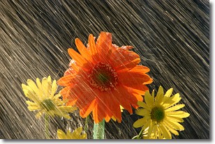
Weather Topic: What is Rain?
Home - Education - Precipitation - Rain
 Next Topic: Shelf Clouds
Precipitation in the form of water droplets is called rain.
Rain generally has a tendency to fall with less intensity over a greater period
of time, and when rainfall is more severe it is usually less sustained.
Rain is the most common form of precipitation and happens with greater frequency
depending on the season and regional influences. Cities have been shown to have
an observable effect on rainfall, due to an effect called the urban heat island.
Compared to upwind, monthly rainfall between twenty and forty miles downwind of
cities is 30% greater.
Next Topic: Shelf Clouds
Current conditions powered by WeatherAPI.com


