Weather Alert in Hawaii
Flash Flood Warning issued February 21 at 3:49AM HST until February 21 at 6:00AM HST by NWS Honolulu HI
AREAS AFFECTED: Kauai, HI
DESCRIPTION: At 349 AM HST, radar indicated heavy rain over windward sections of Kauai, with rain falling at a rate of 2 to 3 inches per hour in the heaviest showers. Additionally, Emergency Management reported that the Princeville side of Kuhio Highway has been closed near the Hanalei River Bridge due to water over the roadway. HAZARD...Flash flooding caused by heavy rain. SOURCE...Radar. IMPACT...Flooding in drainages, streams, rivers, roads, properties, and other low-lying areas. Public road closures possible in some areas. Landslides are possible in steep terrain. Some locations that will experience flash flooding include... The entire island of Kauai.
INSTRUCTION: Stay away from streams, rivers, drainage ditches, and culverts, even if they are currently dry. Do not cross fast flowing or rising water in your vehicle, or on foot. Turn around, don't drown. Be especially cautious at night when it is harder to recognize the dangers of flooding. The heavy rains may cause rock and mudslides in steep terrain areas.
Want more detail? Get the Complete 7 Day and Night Detailed Forecast!
Current U.S. National Radar--Current
The Current National Weather Radar is shown below with a UTC Time (subtract 5 hours from UTC to get Eastern Time).

National Weather Forecast--Current
The Current National Weather Forecast and National Weather Map are shown below.

National Weather Forecast for Tomorrow
Tomorrow National Weather Forecast and Tomorrow National Weather Map are show below.

North America Water Vapor (Moisture)
This map shows recent moisture content over North America. Bright and colored areas show high moisture (ie, clouds); brown indicates very little moisture present; black indicates no moisture.

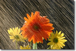
Weather Topic: What is Precipitation?
Home - Education - Precipitation - Precipitation
 Next Topic: Rain
Precipitation can refer to many different forms of water that
may fall from clouds. Precipitation occurs after a cloud has become saturated to
the point where its water particles are more dense than the air below the cloud.
In most cases, precipitation will reach the ground, but it is not uncommon for
precipitation to evaporate before it reaches the earth's surface.
When precipitation evaporates before it contacts the ground it is called Virga.
Graupel, hail, sleet, rain, drizzle, and snow are forms of precipitation, but fog
and mist are not considered precipitation because the water vapor which
constitutes them isn't dense enough to fall to the ground.
Next Topic: Rain
Weather Topic: What are Shelf Clouds?
Home - Education - Cloud Types - Shelf Clouds
 Next Topic: Sleet
A shelf cloud is similar to a wall cloud, but forms at the front
of a storm cloud, instead of at the rear, where wall clouds form.
A shelf cloud is caused by a series of events set into motion by the advancing
storm; first, cool air settles along the ground where precipitation has just fallen.
As the cool air is brought in, the warmer air is displaced, and rises above it,
because it is less dense. When the warmer air reaches the bottom of the storm cloud,
it begins to cool again, and the resulting condensation is a visible shelf cloud.
Next Topic: Sleet
Current conditions powered by WeatherAPI.com


