Weather Alert in Oklahoma
Flood Warning issued August 27 at 8:28PM CDT until August 29 at 8:12PM CDT by NWS Tulsa OK
AREAS AFFECTED: Adair, OK; Cherokee, OK; Delaware, OK
DESCRIPTION: ...The Flood Warning continues for the following rivers in Oklahoma... Illinois River at Chewey affecting Cherokee, Delaware and Adair Counties. * WHAT...Minor flooding is forecast. * WHERE...Illinois River at Chewey. * WHEN...From Friday afternoon to Friday evening. * IMPACTS...At 12.0 feet, minor flooding occurs from near Fidler's Bend to near Hanging Rock. Road access near the river to residential homes southeast of Chewey Bridge may be compromised. Water begins to impact 630 Road east of the Cherokee/Adair County line. Floating the river is too hazardous due to strong turbulence. * ADDITIONAL DETAILS... - At 8:15 PM CDT Wednesday the stage was 3.0 feet. - Forecast...The river is expected to rise above flood stage early Friday afternoon to a crest of 12.1 feet early Friday afternoon. It will then fall below flood stage early Friday afternoon. - Flood stage is 12.0 feet. - http://www.weather.gov/safety/flood
INSTRUCTION: N/A
Want more detail? Get the Complete 7 Day and Night Detailed Forecast!
Current U.S. National Radar--Current
The Current National Weather Radar is shown below with a UTC Time (subtract 5 hours from UTC to get Eastern Time).

National Weather Forecast--Current
The Current National Weather Forecast and National Weather Map are shown below.

National Weather Forecast for Tomorrow
Tomorrow National Weather Forecast and Tomorrow National Weather Map are show below.

North America Water Vapor (Moisture)
This map shows recent moisture content over North America. Bright and colored areas show high moisture (ie, clouds); brown indicates very little moisture present; black indicates no moisture.

Weather Topic: What are Nimbostratus Clouds?
Home - Education - Cloud Types - Nimbostratus Clouds
 Next Topic: Precipitation
A nimbostratus cloud is similar to a stratus cloud in its formless,
smooth appearance. However, a nimbostratus cloud is darker than a stratus cloud,
because it is thicker.
Unlike a stratus cloud, a nimbostratus cloud typically brings with it the threat
of moderate to heavy precipitation. In some cases, the precipitation may evaporate
before reaching the ground, a phenomenon known as virga.
Next Topic: Precipitation
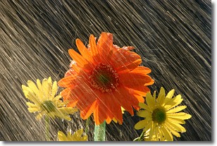
Weather Topic: What is Rain?
Home - Education - Precipitation - Rain
 Next Topic: Shelf Clouds
Precipitation in the form of water droplets is called rain.
Rain generally has a tendency to fall with less intensity over a greater period
of time, and when rainfall is more severe it is usually less sustained.
Rain is the most common form of precipitation and happens with greater frequency
depending on the season and regional influences. Cities have been shown to have
an observable effect on rainfall, due to an effect called the urban heat island.
Compared to upwind, monthly rainfall between twenty and forty miles downwind of
cities is 30% greater.
Next Topic: Shelf Clouds
Current conditions powered by WeatherAPI.com


