Weather Alert in Ohio
Flood Warning issued March 4 at 12:58PM EST until March 4 at 5:30PM EST by NWS Charleston WV
AREAS AFFECTED: Athens, OH; Gallia, OH; Jackson, OH; Meigs, OH; Vinton, OH; Washington, OH; Mason, WV
DESCRIPTION: * WHAT...Flooding caused by excessive rainfall continues. * WHERE...Portions of southeast Ohio, including the following counties, Athens, Gallia, Jackson, Meigs, Vinton and Washington and western West Virginia, including the following county, Mason. * WHEN...Until 530 PM EST. * IMPACTS...Flooding of creeks, small rivers, and other low-lying and flood-prone locations continues this afternoon. This includes the Shade River near Chester which is currently in minor flood. * ADDITIONAL DETAILS... - At 1248 PM EST, Several roads remain closed due to high water as runoff continues to result in creeks at or just above bankfull. This includes a section of Highway 50 just east of McCarthur and State Routes 160 and 349 near Hamden in Vinton County. In addition, portions of State Routes 143 and 124 in Meigs County are closed due to flooding. - Some locations that will experience flooding include... Wellston, Mcarthur, Albany, Racine, Coolville, Rutland, New Haven, Middleport, Chester, Hamden, Syracuse, and Coalton. - http://www.weather.gov/safety/flood
INSTRUCTION: Turn around, don't drown when encountering flooded roads. Most flood deaths occur in vehicles. In hilly terrain there are hundreds of low water crossings which are potentially dangerous in heavy rain. Do not attempt to cross flooded roads. Find an alternate route. Report flooding to the National Weather Service by calling toll free, 800 401 9535, when you can do so safely.
Want more detail? Get the Complete 7 Day and Night Detailed Forecast!
Current U.S. National Radar--Current
The Current National Weather Radar is shown below with a UTC Time (subtract 5 hours from UTC to get Eastern Time).

National Weather Forecast--Current
The Current National Weather Forecast and National Weather Map are shown below.

National Weather Forecast for Tomorrow
Tomorrow National Weather Forecast and Tomorrow National Weather Map are show below.

North America Water Vapor (Moisture)
This map shows recent moisture content over North America. Bright and colored areas show high moisture (ie, clouds); brown indicates very little moisture present; black indicates no moisture.

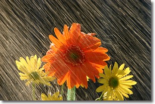
Weather Topic: What is Rain?
Home - Education - Precipitation - Rain
 Next Topic: Shelf Clouds
Precipitation in the form of water droplets is called rain.
Rain generally has a tendency to fall with less intensity over a greater period
of time, and when rainfall is more severe it is usually less sustained.
Rain is the most common form of precipitation and happens with greater frequency
depending on the season and regional influences. Cities have been shown to have
an observable effect on rainfall, due to an effect called the urban heat island.
Compared to upwind, monthly rainfall between twenty and forty miles downwind of
cities is 30% greater.
Next Topic: Shelf Clouds
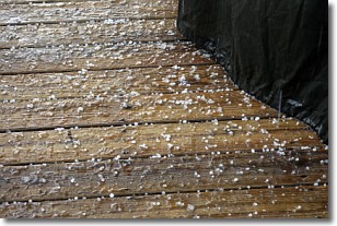
Weather Topic: What is Sleet?
Home - Education - Precipitation - Sleet
 Next Topic: Snow
Sleet is a form of precipitation in which small ice pellets are the primary
components. These ice pellets are smaller and more translucent than hailstones,
and harder than graupel. Sleet is caused by specific atmospheric conditions and
therefore typically doesn't last for extended periods of time.
The condition which leads to sleet formation requires a warmer body of air to be
wedged in between two sub-freezing bodies of air. When snow falls through a warmer
layer of air it melts, and as it falls through the next sub-freezing body of air
it freezes again, forming ice pellets known as sleet. In some cases, water
droplets don't have time to freeze before reaching the surface and the result is
freezing rain.
Next Topic: Snow
Current conditions powered by WeatherAPI.com


