Weather Alert in Indiana
Flood Warning issued March 3 at 10:47PM EST by NWS Indianapolis IN
AREAS AFFECTED: Johnson, IN
DESCRIPTION: ...The Flood Warning continues for the following rivers in Indiana... Haw Creek near Clifford. White River at Elliston. Youngs Creek at Amity. White River at Newberry. ...The Flood Warning is extended for the following rivers in Indiana... East Fork White River at Seymour. .Multiple rounds of rainfall over central Indiana over the next several days are expected to bring at least minor flooding on area rivers and streams. Flooding is expected to develop along portions of the East Fork White and lower White basins over the next 48 hours. Forecast crests issued today include rainfall amounts of 3 to 4 inches over large portions of the East Fork White and lower White basins from this morning through Friday morning, but additional rainfall expected from Friday onward will likely increase crests and lengthen the amount of time in flood. * WHAT...Minor flooding is forecast. * WHERE...Youngs Creek at Amity. * WHEN...From late tonight until further notice. * IMPACTS...At 9.0 feet, Johnson County Roads 350 S and 400 S west of US 31 are closed by flood waters. Upstream in Youngs Creek watershed, flooding of city of Franklin parks with flood waters possibly 3 feet deep in some areas. CR 200 N at CR 75 W on northwest side of Franklin and CR 250 S west of US 31 closed by high water. Amity ditch is out of its banks. * ADDITIONAL DETAILS... - At 10:15 PM EST Tuesday the stage was 6.7 feet. - Forecast...The river is expected to rise above flood stage just after midnight tonight and continue rising to a crest of 8.8 feet tomorrow evening. - Flood stage is 7.0 feet. - http://www.weather.gov/safety/flood
INSTRUCTION: Stay tuned to further developments by listening to your local radio, television, or NOAA Weather Radio for further information. Be especially cautious at night when it is harder to recognize the dangers of flooding. Additional information is available at www.weather.gov/ind. The next statement should be issued Wednesday afternoon by around 100 PM EST.
Want more detail? Get the Complete 7 Day and Night Detailed Forecast!
Current U.S. National Radar--Current
The Current National Weather Radar is shown below with a UTC Time (subtract 5 hours from UTC to get Eastern Time).

National Weather Forecast--Current
The Current National Weather Forecast and National Weather Map are shown below.

National Weather Forecast for Tomorrow
Tomorrow National Weather Forecast and Tomorrow National Weather Map are show below.

North America Water Vapor (Moisture)
This map shows recent moisture content over North America. Bright and colored areas show high moisture (ie, clouds); brown indicates very little moisture present; black indicates no moisture.

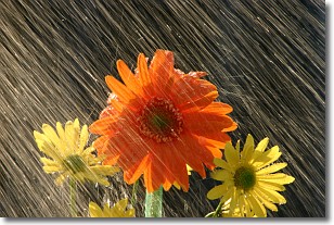
Weather Topic: What is Precipitation?
Home - Education - Precipitation - Precipitation
 Next Topic: Rain
Precipitation can refer to many different forms of water that
may fall from clouds. Precipitation occurs after a cloud has become saturated to
the point where its water particles are more dense than the air below the cloud.
In most cases, precipitation will reach the ground, but it is not uncommon for
precipitation to evaporate before it reaches the earth's surface.
When precipitation evaporates before it contacts the ground it is called Virga.
Graupel, hail, sleet, rain, drizzle, and snow are forms of precipitation, but fog
and mist are not considered precipitation because the water vapor which
constitutes them isn't dense enough to fall to the ground.
Next Topic: Rain
Weather Topic: What are Shelf Clouds?
Home - Education - Cloud Types - Shelf Clouds
 Next Topic: Sleet
A shelf cloud is similar to a wall cloud, but forms at the front
of a storm cloud, instead of at the rear, where wall clouds form.
A shelf cloud is caused by a series of events set into motion by the advancing
storm; first, cool air settles along the ground where precipitation has just fallen.
As the cool air is brought in, the warmer air is displaced, and rises above it,
because it is less dense. When the warmer air reaches the bottom of the storm cloud,
it begins to cool again, and the resulting condensation is a visible shelf cloud.
Next Topic: Sleet
Current conditions powered by WeatherAPI.com


