Weather Alert in Pennsylvania
Severe Thunderstorm Warning issued March 31 at 8:57PM EDT until March 31 at 10:15PM EDT by NWS Pittsburgh PA
AREAS AFFECTED: Armstrong, PA; Butler, PA; Clarion, PA; Forest, PA; Jefferson, PA; Mercer, PA; Venango, PA
DESCRIPTION: SVRPBZ The National Weather Service in Pittsburgh has issued a * Severe Thunderstorm Warning for... Forest County in northwestern Pennsylvania... Southeastern Mercer County in northwestern Pennsylvania... Venango County in northwestern Pennsylvania... Northern Armstrong County in west central Pennsylvania... Northeastern Butler County in west central Pennsylvania... Clarion County in west central Pennsylvania... Jefferson PA County in west central Pennsylvania... * Until 1015 PM EDT. * At 857 PM EDT, severe thunderstorms were located along a line from 15 miles north of Oil City to over Grove City, moving east at 55 mph. HAZARD...60 mph wind gusts. SOURCE...Radar indicated. IMPACT...Expect damage to roofs, siding, and trees. * Locations impacted include... Oil City, Grove City, Franklin, Clarion, Brookville, Marienville, Knox, Sugarcreek, Reynoldsville, Brockway, Tionesta, Hasson Heights, Sykesville, Falls Creek, Seneca, Harrisville, Parker, Polk, Sligo and Emlenton.
INSTRUCTION: Seek shelter inside a well-built structure and stay away from windows. These storms are capable of producing damaging winds.
Want more detail? Get the Complete 7 Day and Night Detailed Forecast!
Current U.S. National Radar--Current
The Current National Weather Radar is shown below with a UTC Time (subtract 5 hours from UTC to get Eastern Time).

National Weather Forecast--Current
The Current National Weather Forecast and National Weather Map are shown below.

National Weather Forecast for Tomorrow
Tomorrow National Weather Forecast and Tomorrow National Weather Map are show below.

North America Water Vapor (Moisture)
This map shows recent moisture content over North America. Bright and colored areas show high moisture (ie, clouds); brown indicates very little moisture present; black indicates no moisture.

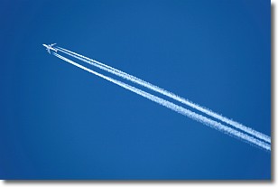
Weather Topic: What are Contrails?
Home - Education - Cloud Types - Contrails
 Next Topic: Cumulonimbus Clouds
A contrail is an artificial cloud, created by the passing of an
aircraft.
Contrails form because water vapor in the exhaust of aircraft engines is suspended
in the air under certain temperatures and humidity conditions. These contrails
are called exhaust contrails.
Another type of contrail can form due to a temporary reduction in air pressure
moving over the plane's surface, causing condensation.
These are called aerodynamic contrails.
When you can see your breath on a cold day, it is also because of condensation.
The reason contrails last longer than the condensation from your breath is
because the water in contrails freezes into ice particles.
Next Topic: Cumulonimbus Clouds
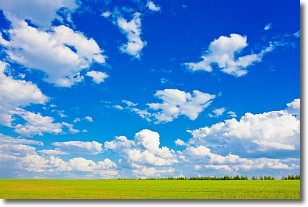
Weather Topic: What are Cumulus Clouds?
Home - Education - Cloud Types - Cumulus Clouds
 Next Topic: Drizzle
Cumulus clouds are fluffy and textured with rounded tops, and
may have flat bottoms. The border of a cumulus cloud
is clearly defined, and can have the appearance of cotton or cauliflower.
Cumulus clouds form at low altitudes (rarely above 2 km) but can grow very tall,
becoming cumulus congestus and possibly the even taller cumulonimbus clouds.
When cumulus clouds become taller, they have a greater chance of producing precipitation.
Next Topic: Drizzle
Current conditions powered by WeatherAPI.com


