Weather Alert in Alaska
Flood Warning issued August 28 at 6:08PM AKDT until August 31 at 10:00AM AKDT by NWS Anchorage AK
AREAS AFFECTED: Western Susitna Valley; Southern Susitna Valley; Central Susitna Valley
DESCRIPTION: * WHAT...Flooding caused by excessive rainfall continues. * WHERE...the Yentna River and tributaries at and above Lake Creek. * WHEN...Until 1000 AM AKDT Sunday. * IMPACTS...At 20.5 feet, water begins to inundate several low-lying cabins. At 22.0 feet, more extensive flooding of cabins, resorts, and private property. * ADDITIONAL DETAILS... - At 545 PM AKDT, Between 1 and 2 inches of rain have fallen. The river gage at Lake Creek and other gages across the Susitna Valley show considerable rises across area rivers. Additional rainfall amounts of around an inch are expected. For Yentna River at Lake Creek: At 5:00pm the stage was 20.9 feet and rising. Flood Stage is 20.5 feet. Forecast: A crest around 23 feet is expected around Friday night into early Saturday morning with an estimated crest time at 4 am Saturday. The river will then begin to fall and is expected to go below flood stage Sunday. This may equal or exceed the August 2024 crest of 22.4 feet. - Http://www.weather.gov/safety/flood
INSTRUCTION: Stay tuned to further developments by listening to your local radio, television, or NOAA Weather Radio for further information.
Want more detail? Get the Complete 7 Day and Night Detailed Forecast!
Current U.S. National Radar--Current
The Current National Weather Radar is shown below with a UTC Time (subtract 5 hours from UTC to get Eastern Time).

National Weather Forecast--Current
The Current National Weather Forecast and National Weather Map are shown below.

National Weather Forecast for Tomorrow
Tomorrow National Weather Forecast and Tomorrow National Weather Map are show below.

North America Water Vapor (Moisture)
This map shows recent moisture content over North America. Bright and colored areas show high moisture (ie, clouds); brown indicates very little moisture present; black indicates no moisture.

Weather Topic: What are Cumulonimbus Clouds?
Home - Education - Cloud Types - Cumulonimbus Clouds
 Next Topic: Cumulus Clouds
The final form taken by a growing cumulus cloud is the
cumulonimbus cloud, which is very tall and dense.
The tower of a cumulonimbus cloud can soar 23 km into the atmosphere, although
most commonly they stop growing at an altitude of 6 km.
Even small cumulonimbus clouds appear very large in comparison to other cloud types.
They can signal the approach of stormy weather, such as thunderstorms or blizzards.
Next Topic: Cumulus Clouds
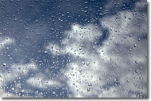
Weather Topic: What is Drizzle?
Home - Education - Precipitation - Drizzle
 Next Topic: Evaporation
Drizzle is precipitation in the form of water droplets which are
smaller than raindrops.
Drizzle is characterized by fine, gently falling droplets and typically does not
impact human habitation in a negative way. The exception to this is freezing drizzle,
a condition where drizzle freezes immediately upon reaching earth's surface.
Freezing drizzle is still less dangerous than freezing rain, but can
potentially result in hazardous road conditions.
Next Topic: Evaporation
Current conditions powered by WeatherAPI.com


