Weather Alert in California
Flood Watch issued February 17 at 2:42AM PST until February 18 at 6:00AM PST by NWS Los Angeles/Oxnard CA
AREAS AFFECTED: Santa Clarita Valley; Ventura County Beaches; Ventura County Inland Coast; Lake Casitas; Ojai Valley; Central Ventura County Valleys; Malibu Coast; Los Angeles County Beaches; Palos Verdes Hills; Los Angeles County Inland Coast including Downtown Los Angeles; Western Santa Monica Mountains Recreational Area; Eastern Santa Monica Mountains Recreational Area; Calabasas and Agoura Hills; Western San Fernando Valley; Eastern San Fernando Valley; Southeastern Ventura County Valleys; Santa Susana Mountains; Southern Ventura County Mountains; Northern Ventura County Mountains; Interstate 5 Corridor; Western San Gabriel Mountains and Highway 14 Corridor; Eastern San Gabriel Mountains; Western Antelope Valley Foothills; Eastern Antelope Valley Foothills; Antelope Valley; Los Angeles County San Gabriel Valley
DESCRIPTION: * WHAT...Flooding caused by excessive rainfall is possible. Rock and mud slides are possible near steep terrain and along canyon roads. Debris flows are possible on recent burn scars. * WHERE...A portion of southwest California, including the following counties, Los Angeles and Ventura Counties. * WHEN...From this evening through late tonight. * IMPACTS...Flash flooding is possible. Excessive runoff may result in flooding of low-lying and flood-prone locations, including creeks and streams. Flooding may occur in poor drainage and urban areas. Low-water crossings may be flooded. Extensive street flooding is possible. * ADDITIONAL DETAILS... - A line of heavy showers and thunderstorms will sweep across the region this evening through tonight, bringing the risk for flash flooding, rock and mud slides, and burn-scar debris flows across the Flood Watch area. Flooding and burn-scar debris flows are not expected for areas above the snow level, of approximately 4500 feet elevation, where snow will fall instead of rain. - http://www.weather.gov/safety/flood
INSTRUCTION: You should monitor later forecasts and be alert for possible Flood Warnings. Those living in areas prone to flooding and recent burn scars should be prepared to take action should flooding develop. Travel through passes and canyons could become dangerous, and be alert for rock slides and mud slides. Follow the direction of Emergency Management and Law Enforcement officials.
Want more detail? Get the Complete 7 Day and Night Detailed Forecast!
Current U.S. National Radar--Current
The Current National Weather Radar is shown below with a UTC Time (subtract 5 hours from UTC to get Eastern Time).

National Weather Forecast--Current
The Current National Weather Forecast and National Weather Map are shown below.

National Weather Forecast for Tomorrow
Tomorrow National Weather Forecast and Tomorrow National Weather Map are show below.

North America Water Vapor (Moisture)
This map shows recent moisture content over North America. Bright and colored areas show high moisture (ie, clouds); brown indicates very little moisture present; black indicates no moisture.

Weather Topic: What are Nimbostratus Clouds?
Home - Education - Cloud Types - Nimbostratus Clouds
 Next Topic: Precipitation
A nimbostratus cloud is similar to a stratus cloud in its formless,
smooth appearance. However, a nimbostratus cloud is darker than a stratus cloud,
because it is thicker.
Unlike a stratus cloud, a nimbostratus cloud typically brings with it the threat
of moderate to heavy precipitation. In some cases, the precipitation may evaporate
before reaching the ground, a phenomenon known as virga.
Next Topic: Precipitation
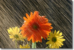
Weather Topic: What is Rain?
Home - Education - Precipitation - Rain
 Next Topic: Shelf Clouds
Precipitation in the form of water droplets is called rain.
Rain generally has a tendency to fall with less intensity over a greater period
of time, and when rainfall is more severe it is usually less sustained.
Rain is the most common form of precipitation and happens with greater frequency
depending on the season and regional influences. Cities have been shown to have
an observable effect on rainfall, due to an effect called the urban heat island.
Compared to upwind, monthly rainfall between twenty and forty miles downwind of
cities is 30% greater.
Next Topic: Shelf Clouds
Current conditions powered by WeatherAPI.com


