Weather Alert in Oregon
Beach Hazards Statement issued February 9 at 12:33PM PST until February 15 at 10:00PM PST by NWS Portland OR
AREAS AFFECTED: Clatsop County Coast; Tillamook County Coast; Central Coast of Oregon; South Washington Coast
DESCRIPTION: * WHAT...Sneaker waves possible. * WHERE...North and Central Coast of Oregon, and South Washington Coast. * WHEN...From late Thursday night through Sunday evening. * IMPACTS...Waves can run up significantly farther on a beach than normal, including over rocks and jetties. Sneaker waves can suddenly knock people off of their feet and quickly pull them into the frigid ocean which may lead to serious injury or drowning. * ADDITIONAL DETAILS...Caution should be used when in or near the water, especially those who will be razor clamming. Keep children and pets away from the surf zone. Keep off of jetties, rocks and logs near the surf zone. If you see someone swept into the sea do not swim in after them. Call 911 and keep an eye on them until help arrives.
INSTRUCTION: Remain out of the water to avoid hazardous swimming conditions.
Want more detail? Get the Complete 7 Day and Night Detailed Forecast!
Current U.S. National Radar--Current
The Current National Weather Radar is shown below with a UTC Time (subtract 5 hours from UTC to get Eastern Time).

National Weather Forecast--Current
The Current National Weather Forecast and National Weather Map are shown below.

National Weather Forecast for Tomorrow
Tomorrow National Weather Forecast and Tomorrow National Weather Map are show below.

North America Water Vapor (Moisture)
This map shows recent moisture content over North America. Bright and colored areas show high moisture (ie, clouds); brown indicates very little moisture present; black indicates no moisture.

Weather Topic: What are Nimbostratus Clouds?
Home - Education - Cloud Types - Nimbostratus Clouds
 Next Topic: Precipitation
A nimbostratus cloud is similar to a stratus cloud in its formless,
smooth appearance. However, a nimbostratus cloud is darker than a stratus cloud,
because it is thicker.
Unlike a stratus cloud, a nimbostratus cloud typically brings with it the threat
of moderate to heavy precipitation. In some cases, the precipitation may evaporate
before reaching the ground, a phenomenon known as virga.
Next Topic: Precipitation
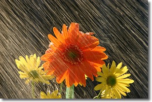
Weather Topic: What is Rain?
Home - Education - Precipitation - Rain
 Next Topic: Shelf Clouds
Precipitation in the form of water droplets is called rain.
Rain generally has a tendency to fall with less intensity over a greater period
of time, and when rainfall is more severe it is usually less sustained.
Rain is the most common form of precipitation and happens with greater frequency
depending on the season and regional influences. Cities have been shown to have
an observable effect on rainfall, due to an effect called the urban heat island.
Compared to upwind, monthly rainfall between twenty and forty miles downwind of
cities is 30% greater.
Next Topic: Shelf Clouds
Current conditions powered by WeatherAPI.com


