Weather Alert in Montana
Winter Weather Advisory issued February 16 at 11:54PM MST until February 17 at 11:00PM MST by NWS Great Falls MT
AREAS AFFECTED: Hill County
DESCRIPTION: * WHAT...Snow and blowing snow expected. Total snow accumulations between 1 and 3 inches. Winds gusting as high as 50 mph. * WHERE...Hill County. * WHEN...From 11 AM to 11 PM MST Tuesday. * IMPACTS...Plan on slippery road conditions. Areas of blowing snow could significantly reduce visibility. * ADDITIONAL DETAILS...Rain and snow showers developing Tuesday afternoon will transition to a period of snow late Tuesday afternoon and evening. Gusty northwest winds and sharply falling temperatures are expected to develop Tuesday afternoon through Tuesday evening. While snowfall amounts are relatively low, the combination of gusty winds and blowing or drifting snow may also occur with previously wet road surfaces that become icy as temperatures fall.
INSTRUCTION: Slow down and use caution while traveling. The latest road conditions can be obtained by calling 5 1 1 or visiting the MDT Road Report website. To see a graphical representation of the degree of stress on young livestock please visit our webpage and select Local Programs then Cold Air Advisory for Newborn Livestock. Remember, a Winter Weather Advisory means that there is at least an 80% chance of minor impacts due to winter weather conditions during the advisory period.
Want more detail? Get the Complete 7 Day and Night Detailed Forecast!
Current U.S. National Radar--Current
The Current National Weather Radar is shown below with a UTC Time (subtract 5 hours from UTC to get Eastern Time).

National Weather Forecast--Current
The Current National Weather Forecast and National Weather Map are shown below.

National Weather Forecast for Tomorrow
Tomorrow National Weather Forecast and Tomorrow National Weather Map are show below.

North America Water Vapor (Moisture)
This map shows recent moisture content over North America. Bright and colored areas show high moisture (ie, clouds); brown indicates very little moisture present; black indicates no moisture.

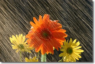
Weather Topic: What is Rain?
Home - Education - Precipitation - Rain
 Next Topic: Shelf Clouds
Precipitation in the form of water droplets is called rain.
Rain generally has a tendency to fall with less intensity over a greater period
of time, and when rainfall is more severe it is usually less sustained.
Rain is the most common form of precipitation and happens with greater frequency
depending on the season and regional influences. Cities have been shown to have
an observable effect on rainfall, due to an effect called the urban heat island.
Compared to upwind, monthly rainfall between twenty and forty miles downwind of
cities is 30% greater.
Next Topic: Shelf Clouds
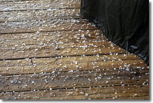
Weather Topic: What is Sleet?
Home - Education - Precipitation - Sleet
 Next Topic: Snow
Sleet is a form of precipitation in which small ice pellets are the primary
components. These ice pellets are smaller and more translucent than hailstones,
and harder than graupel. Sleet is caused by specific atmospheric conditions and
therefore typically doesn't last for extended periods of time.
The condition which leads to sleet formation requires a warmer body of air to be
wedged in between two sub-freezing bodies of air. When snow falls through a warmer
layer of air it melts, and as it falls through the next sub-freezing body of air
it freezes again, forming ice pellets known as sleet. In some cases, water
droplets don't have time to freeze before reaching the surface and the result is
freezing rain.
Next Topic: Snow
Current conditions powered by WeatherAPI.com


