Weather Alert in Kentucky
Severe Thunderstorm Watch issued September 5 at 5:45PM EDT until September 6 at 1:00AM EDT by NWS Jackson KY
AREAS AFFECTED: Bell, KY; Breathitt, KY; Clay, KY; Elliott, KY; Estill, KY; Floyd, KY; Harlan, KY; Jackson, KY; Johnson, KY; Knott, KY; Knox, KY; Laurel, KY; Lee, KY; Leslie, KY; Letcher, KY; McCreary, KY; Magoffin, KY; Martin, KY; Menifee, KY; Morgan, KY; Owsley, KY; Perry, KY; Pike, KY; Powell, KY; Pulaski, KY; Rockcastle, KY; Wayne, KY; Whitley, KY; Wolfe, KY
DESCRIPTION: THE NATIONAL WEATHER SERVICE HAS ISSUED SEVERE THUNDERSTORM WATCH 606 IN EFFECT UNTIL 1 AM EDT SATURDAY FOR THE FOLLOWING AREAS IN KENTUCKY THIS WATCH INCLUDES 29 COUNTIES IN EAST CENTRAL KENTUCKY ELLIOTT ESTILL MENIFEE POWELL IN NORTHEAST KENTUCKY JOHNSON MARTIN IN SOUTH CENTRAL KENTUCKY LAUREL MCCREARY PULASKI ROCKCASTLE WAYNE WHITLEY IN SOUTHEAST KENTUCKY BELL BREATHITT CLAY FLOYD HARLAN JACKSON KNOTT KNOX LEE LESLIE LETCHER MAGOFFIN MORGAN OWSLEY PERRY PIKE WOLFE THIS INCLUDES THE CITIES OF ANNVILLE, BARBOURVILLE, BEATTYVILLE, BOONEVILLE, BRODHEAD, BURNSIDE, CAMPTON, CLAY CITY, COAL RUN, CORBIN, CUMBERLAND, ELKHORN CITY, FRENCHBURG, HARLAN, HAZARD, HINDMAN, HYDEN, INEZ, IRVINE, JACKSON, JENKINS, LONDON, MANCHESTER, MCKEE, MIDDLESBORO, MONTICELLO, MOUNT VERNON, PAINTSVILLE, PIKEVILLE, PINEVILLE, PIPPA PASSES, PRESTONSBURG, RAVENNA, SALYERSVILLE, SANDY HOOK, SOMERSET, SOUTH WILLIAMSON, STANTON, STEARNS, WEST LIBERTY, WHEELWRIGHT, WHITESBURG, WHITLEY CITY, AND WILLIAMSBURG.
INSTRUCTION: N/A
Want more detail? Get the Complete 7 Day and Night Detailed Forecast!
Current U.S. National Radar--Current
The Current National Weather Radar is shown below with a UTC Time (subtract 5 hours from UTC to get Eastern Time).

National Weather Forecast--Current
The Current National Weather Forecast and National Weather Map are shown below.

National Weather Forecast for Tomorrow
Tomorrow National Weather Forecast and Tomorrow National Weather Map are show below.

North America Water Vapor (Moisture)
This map shows recent moisture content over North America. Bright and colored areas show high moisture (ie, clouds); brown indicates very little moisture present; black indicates no moisture.

Weather Topic: What are Cumulonimbus Clouds?
Home - Education - Cloud Types - Cumulonimbus Clouds
 Next Topic: Cumulus Clouds
The final form taken by a growing cumulus cloud is the
cumulonimbus cloud, which is very tall and dense.
The tower of a cumulonimbus cloud can soar 23 km into the atmosphere, although
most commonly they stop growing at an altitude of 6 km.
Even small cumulonimbus clouds appear very large in comparison to other cloud types.
They can signal the approach of stormy weather, such as thunderstorms or blizzards.
Next Topic: Cumulus Clouds
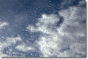
Weather Topic: What is Drizzle?
Home - Education - Precipitation - Drizzle
 Next Topic: Evaporation
Drizzle is precipitation in the form of water droplets which are
smaller than raindrops.
Drizzle is characterized by fine, gently falling droplets and typically does not
impact human habitation in a negative way. The exception to this is freezing drizzle,
a condition where drizzle freezes immediately upon reaching earth's surface.
Freezing drizzle is still less dangerous than freezing rain, but can
potentially result in hazardous road conditions.
Next Topic: Evaporation
Current conditions powered by WeatherAPI.com


