Weather Alert in California
Avalanche Warning issued February 17 at 5:19AM PST by NWS Reno NV
AREAS AFFECTED: Greater Lake Tahoe Area; Greater Lake Tahoe Area
DESCRIPTION: AVWREV The following message is transmitted at the request of the U.S. Forest Service Sierra Avalanche Center. The Sierra Avalanche Center in Truckee has issued a BACKCOUNTRY AVALANCHE WARNING for the following areas: NWS Reno NV - NVZ002 (Greater Lake Tahoe)...CAZ072 (Greater Lake Tahoe (CA)) * WHAT...HIGH avalanche danger exists in the backcountry. Large avalanches are expected to occur Tuesday, Tuesday night, and into at least early Wednesday morning across backcountry terrain. HIGH avalanche danger might continue through the day on Wednesday. * WHERE...Central Sierra Nevada Mountains between Yuba Pass (Highway 49) on the north and Ebbetts Pass (Highway 4) on the south, including the greater Lake Tahoe area. This does not include ski areas or highways where avalanche mitigation programs exist. * WHEN...In effect from Tuesday 5 AM PST to Wednesday 5 PM PST. * IMPACTS...Rapidly accumulating snowfall, weak layers in the existing snowpack, and gale-force winds that blow and drift snow have created dangerous avalanche conditions in the mountains. Natural avalanches are likely, and human-triggered avalanches large enough to bury or injure people are very likely. * PRECAUTIONARY / PREPAREDNESS ACTIONS...Traveling in, near, or below backcountry avalanche terrain is not recommended during HIGH avalanche danger. Consult https://www.sierraavalanchecenter.org/ or www.avalanche.org for more detailed information. Similar avalanche danger may exist at locations outside the coverage area of this or any avalanche center.
INSTRUCTION: N/A
Want more detail? Get the Complete 7 Day and Night Detailed Forecast!
Current U.S. National Radar--Current
The Current National Weather Radar is shown below with a UTC Time (subtract 5 hours from UTC to get Eastern Time).

National Weather Forecast--Current
The Current National Weather Forecast and National Weather Map are shown below.

National Weather Forecast for Tomorrow
Tomorrow National Weather Forecast and Tomorrow National Weather Map are show below.

North America Water Vapor (Moisture)
This map shows recent moisture content over North America. Bright and colored areas show high moisture (ie, clouds); brown indicates very little moisture present; black indicates no moisture.

Weather Topic: What are Cirrus Clouds?
Home - Education - Cloud Types - Cirrus Clouds
 Next Topic: Condensation
Cirrus clouds are high-level clouds that occur above 20,000 feet
and are composed mainly of ice crystals.
They are thin and wispy in appearance.
What do they indicate?
They are often the first sign of an approaching storm.
Next Topic: Condensation
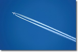
Weather Topic: What are Contrails?
Home - Education - Cloud Types - Contrails
 Next Topic: Cumulonimbus Clouds
A contrail is an artificial cloud, created by the passing of an
aircraft.
Contrails form because water vapor in the exhaust of aircraft engines is suspended
in the air under certain temperatures and humidity conditions. These contrails
are called exhaust contrails.
Another type of contrail can form due to a temporary reduction in air pressure
moving over the plane's surface, causing condensation.
These are called aerodynamic contrails.
When you can see your breath on a cold day, it is also because of condensation.
The reason contrails last longer than the condensation from your breath is
because the water in contrails freezes into ice particles.
Next Topic: Cumulonimbus Clouds
Current conditions powered by WeatherAPI.com


