Weather Alert in Indiana
Flood Advisory issued March 4 at 9:48AM EST until March 4 at 1:00PM EST by NWS Wilmington OH
AREAS AFFECTED: Fayette, IN; Franklin, IN; Union, IN
DESCRIPTION: * WHAT...Flooding caused by excessive rainfall continues. * WHERE...The following counties, in east central Indiana, Fayette and Union. In southeast Indiana, Franklin. * WHEN...Until 100 PM EST. * IMPACTS...Minor flooding in low-lying and poor drainage areas. Some low-water crossings may become impassable. * ADDITIONAL DETAILS... - At 948 AM EST, local law enforcement reported minor flooding in the advisory area. Between 2 and 3.5 inches of rain have fallen. Flooding impacts will slowly improve, but no significant additional rainfall is expected until this evening and overnight tonight. - Some locations that may experience flooding include... Connersville, Batesville, Brookville, Liberty, West College Corner, Oldenburg, Glenwood, Lake Santee, Salem, Waterloo, Blooming Grove, Columbia, Metamora, Bunker Hill, Brownsville, St. Leon, Laurel, Scipio, College Corner and Cedar Grove.
INSTRUCTION: Be aware of your surroundings and do not drive on flooded roads. To report flooding, go to our website at weather.gov/iln and submit your report via social media, when you can do so safely.
Want more detail? Get the Complete 7 Day and Night Detailed Forecast!
Current U.S. National Radar--Current
The Current National Weather Radar is shown below with a UTC Time (subtract 5 hours from UTC to get Eastern Time).

National Weather Forecast--Current
The Current National Weather Forecast and National Weather Map are shown below.

National Weather Forecast for Tomorrow
Tomorrow National Weather Forecast and Tomorrow National Weather Map are show below.

North America Water Vapor (Moisture)
This map shows recent moisture content over North America. Bright and colored areas show high moisture (ie, clouds); brown indicates very little moisture present; black indicates no moisture.

Weather Topic: What are Nimbostratus Clouds?
Home - Education - Cloud Types - Nimbostratus Clouds
 Next Topic: Precipitation
A nimbostratus cloud is similar to a stratus cloud in its formless,
smooth appearance. However, a nimbostratus cloud is darker than a stratus cloud,
because it is thicker.
Unlike a stratus cloud, a nimbostratus cloud typically brings with it the threat
of moderate to heavy precipitation. In some cases, the precipitation may evaporate
before reaching the ground, a phenomenon known as virga.
Next Topic: Precipitation
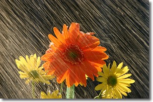
Weather Topic: What is Rain?
Home - Education - Precipitation - Rain
 Next Topic: Shelf Clouds
Precipitation in the form of water droplets is called rain.
Rain generally has a tendency to fall with less intensity over a greater period
of time, and when rainfall is more severe it is usually less sustained.
Rain is the most common form of precipitation and happens with greater frequency
depending on the season and regional influences. Cities have been shown to have
an observable effect on rainfall, due to an effect called the urban heat island.
Compared to upwind, monthly rainfall between twenty and forty miles downwind of
cities is 30% greater.
Next Topic: Shelf Clouds
Current conditions powered by WeatherAPI.com


