Weather Alert in Texas
Heat Advisory issued May 13 at 1:25PM CDT until May 14 at 7:00PM CDT by NWS San Angelo TX
AREAS AFFECTED: Menard
DESCRIPTION: * WHAT...Temperatures around 105 degrees expected Wednesday afternoon. * WHERE...Menard County. * WHEN...From 1 PM to 7 PM CDT Wednesday. * IMPACTS...Hot temperatures may cause heat illnesses.
INSTRUCTION: A Heat Advisory means that hot weather conditions are occurring or expected. This will create a situation in which heat illnesses are possible. Never, ever, leave children or pets alone in enclosed vehicles, not even for a few minutes. Car interiors can reach lethal temperatures in a matter of minutes. Stay indoors and seek air-conditioned buildings. Drink water more than usual, and avoid dehydrating alcoholic, sugary, or caffeinated drinks. Dress for the heat by wearing lightweight and light colored clothing. Eat small meals and eat more often. Monitor those with a higher vulnerability to heat, including small children. Check in on family, friends, and neighbors, especially the elderly. If engaging in outdoor activity, take longer and more frequent breaks and avoid the hottest parts of the day.
Want more detail? Get the Complete 7 Day and Night Detailed Forecast!
Current U.S. National Radar--Current
The Current National Weather Radar is shown below with a UTC Time (subtract 5 hours from UTC to get Eastern Time).

National Weather Forecast--Current
The Current National Weather Forecast and National Weather Map are shown below.

National Weather Forecast for Tomorrow
Tomorrow National Weather Forecast and Tomorrow National Weather Map are show below.

North America Water Vapor (Moisture)
This map shows recent moisture content over North America. Bright and colored areas show high moisture (ie, clouds); brown indicates very little moisture present; black indicates no moisture.

Weather Topic: What is Drizzle?
Home - Education - Precipitation - Drizzle
 Next Topic: Evaporation
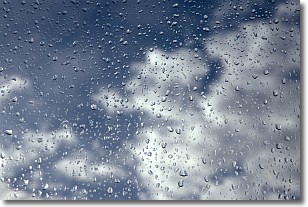
Drizzle is precipitation in the form of water droplets which are
smaller than raindrops.
Drizzle is characterized by fine, gently falling droplets and typically does not
impact human habitation in a negative way. The exception to this is freezing drizzle,
a condition where drizzle freezes immediately upon reaching earth's surface.
Freezing drizzle is still less dangerous than freezing rain, but can
potentially result in hazardous road conditions.
Next Topic: Evaporation
Weather Topic: What is Fog?
Home - Education - Cloud Types - Fog
 Next Topic: Fractus Clouds
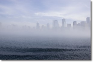
Fog is technically a type of stratus cloud, which lies along the
ground and obscures visibility.
It is usually created when humidity in the air condenses into tiny water droplets.
Because of this, some places are more prone to foggy weather, such as regions
close to a body of water.
Fog is similar to mist; both are the appearance of water droplets suspended in
the air, but fog is the term applied to the condition when visibility is less than 1 km.
Next Topic: Fractus Clouds
Current conditions powered by WeatherAPI.com


