Weather Alert in California
Red Flag Warning issued June 30 at 1:28PM PDT until July 1 at 8:00PM PDT by NWS Sacramento CA
AREAS AFFECTED: Eastern Portion of Shasta/Trinity NF; Burney Basin and Northeast Plateau in Shasta County Including Northwest Lassen NF north of Lassen NP; Southeast Edge Shasta/Trinity NF and Western Portions of Tehama/Glenn RU; Northern Sierra Foothills from 1000 to 3000 Ft. Includes Nevada-Yuba-Placer RU and Anador-Eldorado RU; Northern Sierra Including Lassen NP and Plumas and Lassen NF/S West of the Sierra Crest - West of Evans Peak/Grizzly Peak/Beckworth Peak; Eastern Mendocino NF
DESCRIPTION: * Affected Area...Fire Zone 213 Eastern Portion of Shasta/Trinity NF, Fire Zone 214 Burney Basin and Northeast Plateau in Shasta County Including Northwest Lassen NF north of Lassen NP, Fire Zone 263 Southeast Edge Shasta-Trinity NF and Western Portions of Tehama-Glenn Unit, Fire Zone 266 Northern Sierra Foothills from 1000 to 3000 Ft. Includes portions of Shasta-Trinity and Butte Units, Fire Zone 268 Northern Sierra Including Lassen NP and Plumas and Lassen NF/S West of the Sierra Crest (West of Evans Peak-Grizzly Peak- Beckworth Peak) and Fire Zone 279 Eastern Mendocino NF. * Thunderstorms...Isolated to scattered coverage of a mix of wet and dry thunderstorms expected. Lightning strikes may also occur outside of main precipitation cores. Highest chances for thunderstorms in the afternoon and evening hours. * Outflow Winds...Gusty and erratic outflow winds could occur near any thunderstorm development. * Impacts...Lightning can create new fire starts and may combine with gusty outflow winds to cause a fire to rapidly grow in size and intensity. *
INSTRUCTION: A Red Flag Warning means that critical fire weather conditions are either occurring now, or will shortly. A combination of lightning from dry thunderstorms on dry fuels can contribute to new fire starts.
Want more detail? Get the Complete 7 Day and Night Detailed Forecast!
Current U.S. National Radar--Current
The Current National Weather Radar is shown below with a UTC Time (subtract 5 hours from UTC to get Eastern Time).

National Weather Forecast--Current
The Current National Weather Forecast and National Weather Map are shown below.

National Weather Forecast for Tomorrow
Tomorrow National Weather Forecast and Tomorrow National Weather Map are show below.

North America Water Vapor (Moisture)
This map shows recent moisture content over North America. Bright and colored areas show high moisture (ie, clouds); brown indicates very little moisture present; black indicates no moisture.

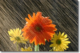
Weather Topic: What is Rain?
Home - Education - Precipitation - Rain
 Next Topic: Shelf Clouds
Precipitation in the form of water droplets is called rain.
Rain generally has a tendency to fall with less intensity over a greater period
of time, and when rainfall is more severe it is usually less sustained.
Rain is the most common form of precipitation and happens with greater frequency
depending on the season and regional influences. Cities have been shown to have
an observable effect on rainfall, due to an effect called the urban heat island.
Compared to upwind, monthly rainfall between twenty and forty miles downwind of
cities is 30% greater.
Next Topic: Shelf Clouds
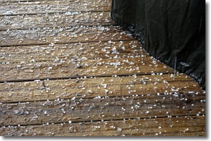
Weather Topic: What is Sleet?
Home - Education - Precipitation - Sleet
 Next Topic: Snow
Sleet is a form of precipitation in which small ice pellets are the primary
components. These ice pellets are smaller and more translucent than hailstones,
and harder than graupel. Sleet is caused by specific atmospheric conditions and
therefore typically doesn't last for extended periods of time.
The condition which leads to sleet formation requires a warmer body of air to be
wedged in between two sub-freezing bodies of air. When snow falls through a warmer
layer of air it melts, and as it falls through the next sub-freezing body of air
it freezes again, forming ice pellets known as sleet. In some cases, water
droplets don't have time to freeze before reaching the surface and the result is
freezing rain.
Next Topic: Snow
Current conditions powered by WeatherAPI.com


