Weather Alert in Colorado
Red Flag Warning issued February 17 at 10:19AM MST until February 18 at 7:00PM MST by NWS Denver CO
AREAS AFFECTED: North and Northeast Elbert County Below 6000 Feet/North Lincoln County; Southeast Elbert County Below 6000 Feet/South Lincoln County
DESCRIPTION: ...CRITICAL TO EXTREMELY CRITICAL FIRE WEATHER CONDITIONS LIKELY TUESDAY... The National Weather Service in Denver has issued a Red Flag Warning for wind and low relative humidity, which is in effect from 11 AM to 7 PM MST Wednesday. * AFFECTED AREA...Fire Weather Zones 246 and 247. * TIMING...For the first Red Flag Warning, until 7 PM MST this evening. For the second Red Flag Warning, from 11 AM to 7 PM MST Wednesday. * WINDS...Southwest 20 to 30 mph with gusts up to 50 mph. * RELATIVE HUMIDITY...As low as 12 percent. * IMPACTS...Conditions will be favorable for rapid fire spread. Avoid outdoor burning and any activity that may produce a spark and start a wildfire.
INSTRUCTION: A Red Flag Warning means that critical fire weather conditions are either occurring now....or will shortly. A combination of strong winds...low relative humidity...and warm temperatures can contribute to extreme fire behavior.
Want more detail? Get the Complete 7 Day and Night Detailed Forecast!
Current U.S. National Radar--Current
The Current National Weather Radar is shown below with a UTC Time (subtract 5 hours from UTC to get Eastern Time).

National Weather Forecast--Current
The Current National Weather Forecast and National Weather Map are shown below.

National Weather Forecast for Tomorrow
Tomorrow National Weather Forecast and Tomorrow National Weather Map are show below.

North America Water Vapor (Moisture)
This map shows recent moisture content over North America. Bright and colored areas show high moisture (ie, clouds); brown indicates very little moisture present; black indicates no moisture.

Weather Topic: What are Nimbostratus Clouds?
Home - Education - Cloud Types - Nimbostratus Clouds
 Next Topic: Precipitation
A nimbostratus cloud is similar to a stratus cloud in its formless,
smooth appearance. However, a nimbostratus cloud is darker than a stratus cloud,
because it is thicker.
Unlike a stratus cloud, a nimbostratus cloud typically brings with it the threat
of moderate to heavy precipitation. In some cases, the precipitation may evaporate
before reaching the ground, a phenomenon known as virga.
Next Topic: Precipitation
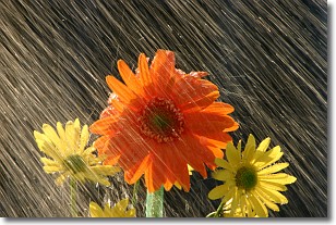
Weather Topic: What is Rain?
Home - Education - Precipitation - Rain
 Next Topic: Shelf Clouds
Precipitation in the form of water droplets is called rain.
Rain generally has a tendency to fall with less intensity over a greater period
of time, and when rainfall is more severe it is usually less sustained.
Rain is the most common form of precipitation and happens with greater frequency
depending on the season and regional influences. Cities have been shown to have
an observable effect on rainfall, due to an effect called the urban heat island.
Compared to upwind, monthly rainfall between twenty and forty miles downwind of
cities is 30% greater.
Next Topic: Shelf Clouds
Current conditions powered by WeatherAPI.com


