Weather Alert in Minnesota
Winter Weather Advisory issued February 24 at 10:06AM CST until February 24 at 3:00PM CST by NWS La Crosse WI
AREAS AFFECTED: Wabasha; Dodge; Olmsted; Winona; Mower; Fillmore; Houston; Buffalo; Trempealeau; La Crosse; Vernon
DESCRIPTION: ...WINTRY MIX MOVING INTO THE REGION BY NOON... .A narrow band of wintry mix will move through portions of southeast Minnesota and western Wisconsin this afternoon which may lead to slick road conditions in spots. Numerous accidents have already been noted with ongoing precipitation in the Twin Cities metro area. Motorists are encouraged to slow down when encountering slick roads. * WHAT...Mixed precipitation resulting in a glaze of ice on roadways. * WHERE...Portions of southeast Minnesota and southwest and west central Wisconsin. * WHEN...Until 3 PM CST this afternoon. * IMPACTS...Plan on slippery road conditions.
INSTRUCTION: Slow down and use caution while traveling. In Minnesota, visit 511mn.org for road conditions. In Wisconsin, visit 511wi.gov for road conditions.
Want more detail? Get the Complete 7 Day and Night Detailed Forecast!
Current U.S. National Radar--Current
The Current National Weather Radar is shown below with a UTC Time (subtract 5 hours from UTC to get Eastern Time).

National Weather Forecast--Current
The Current National Weather Forecast and National Weather Map are shown below.

National Weather Forecast for Tomorrow
Tomorrow National Weather Forecast and Tomorrow National Weather Map are show below.

North America Water Vapor (Moisture)
This map shows recent moisture content over North America. Bright and colored areas show high moisture (ie, clouds); brown indicates very little moisture present; black indicates no moisture.

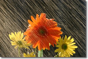
Weather Topic: What is Precipitation?
Home - Education - Precipitation - Precipitation
 Next Topic: Rain
Precipitation can refer to many different forms of water that
may fall from clouds. Precipitation occurs after a cloud has become saturated to
the point where its water particles are more dense than the air below the cloud.
In most cases, precipitation will reach the ground, but it is not uncommon for
precipitation to evaporate before it reaches the earth's surface.
When precipitation evaporates before it contacts the ground it is called Virga.
Graupel, hail, sleet, rain, drizzle, and snow are forms of precipitation, but fog
and mist are not considered precipitation because the water vapor which
constitutes them isn't dense enough to fall to the ground.
Next Topic: Rain
Weather Topic: What are Shelf Clouds?
Home - Education - Cloud Types - Shelf Clouds
 Next Topic: Sleet
A shelf cloud is similar to a wall cloud, but forms at the front
of a storm cloud, instead of at the rear, where wall clouds form.
A shelf cloud is caused by a series of events set into motion by the advancing
storm; first, cool air settles along the ground where precipitation has just fallen.
As the cool air is brought in, the warmer air is displaced, and rises above it,
because it is less dense. When the warmer air reaches the bottom of the storm cloud,
it begins to cool again, and the resulting condensation is a visible shelf cloud.
Next Topic: Sleet
Current conditions powered by WeatherAPI.com


